|
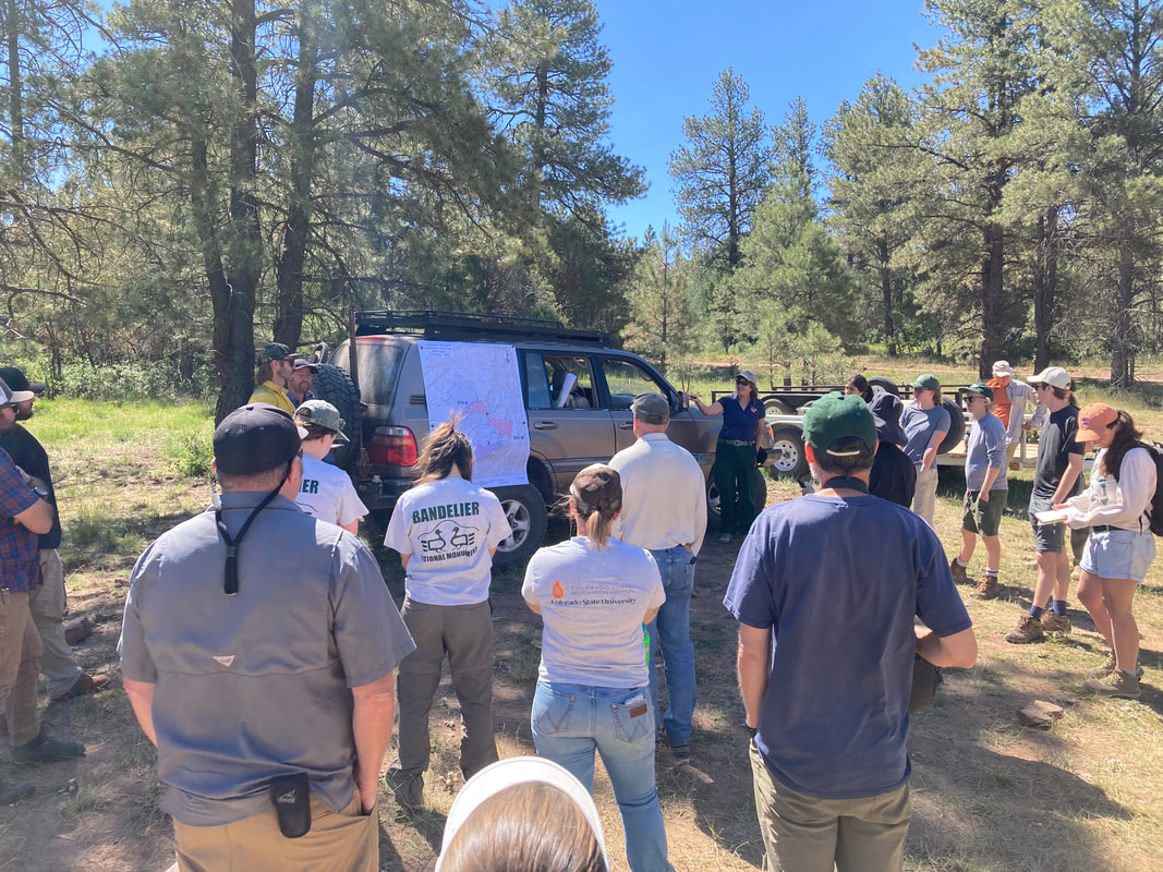
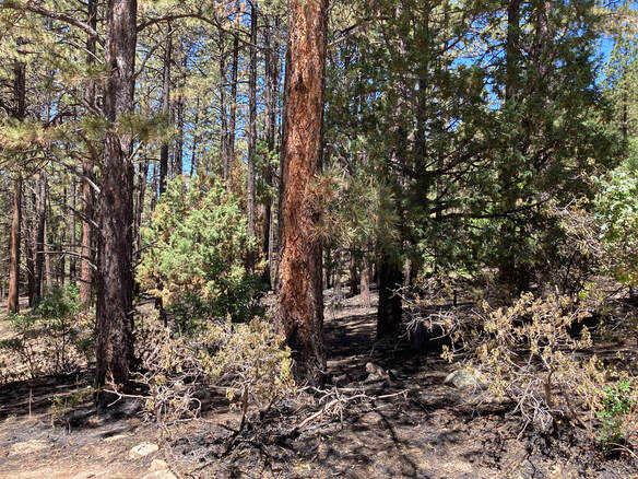
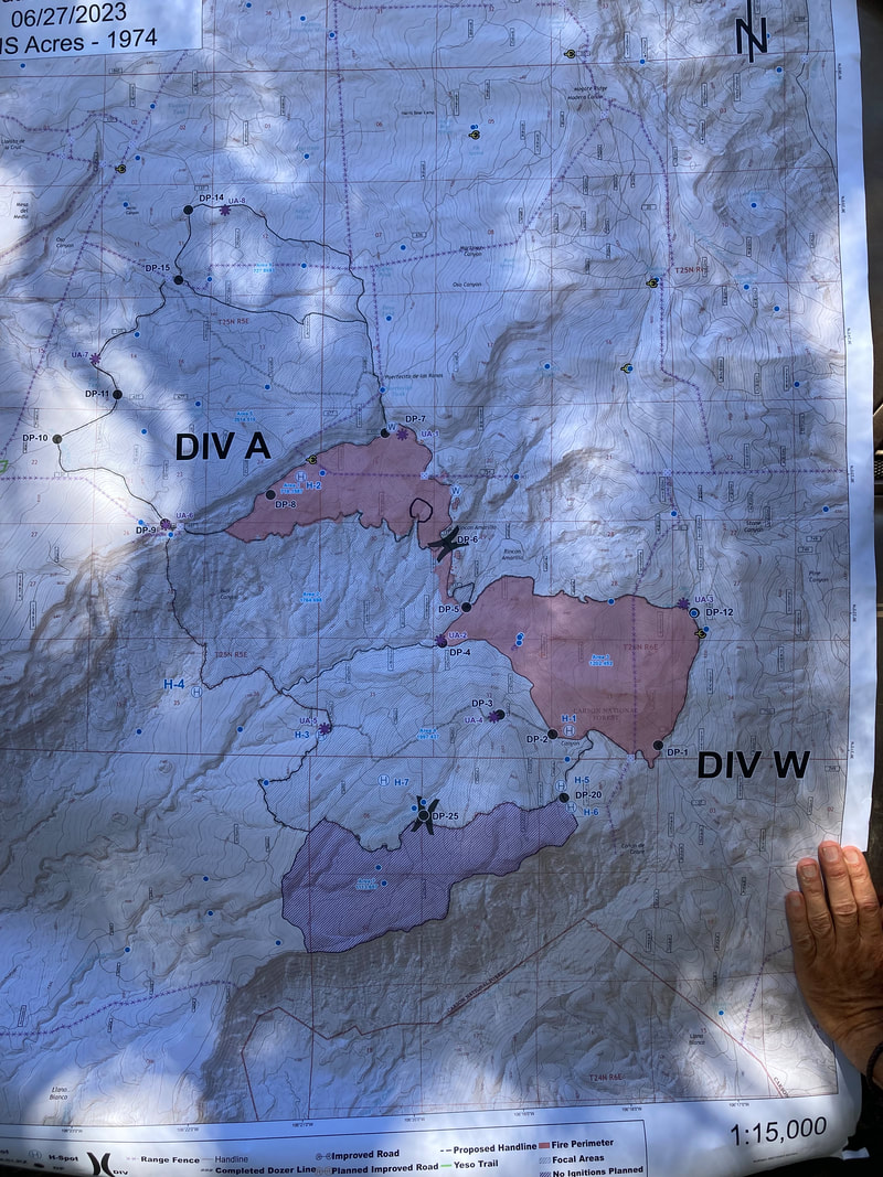
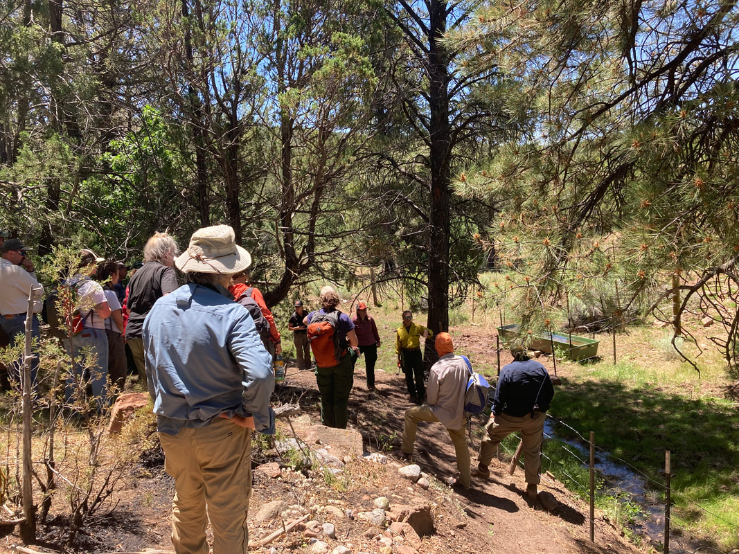
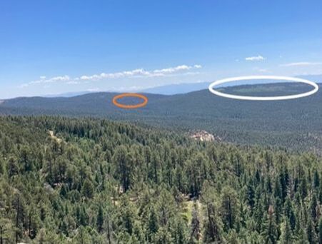
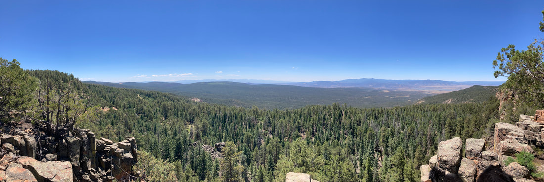
This post follows a more general post about managed fire, which you can read here. One of the best parts about my job is that I have a backstage pass to the natural world. As my friend and colleague Craig Allen likes to say, as scientists “we are interpreters for the natural world”. On 6 July I got to tour the Comanche Fire on the El Rito ranger district of the Carson National Forest with District Ranger Angie Krall and a number of staff members from the Carson. It is still an active fire, so we got briefed by the Incident Commander on operations and we got an overview of the decision-making around this ignition and their choice not to immediately suppress the fire. The people on the field tour included researchers, non-Forest Service collaborators working in the area, and a couple of members of the press. What follows is my summary of the information. Since I was typing this on my phone and my thumbs are large and I’m at the age where I need cheaters to read, anything (dates, acres, etc) that is incorrect is because I either didn’t hear it correctly or wrote it down incorrectly. These dates and numbers may be important to some, but what is important about managed fire is the decision-making process and the outcome. Those are where I focused my attention. The Comanche Fire started as a lightening ignition on 8 June. Here is a photo of the ignition site. The ignition site is in complex terrain, which is fire manager speak for rugged country (e.g. cliffs, canyons, peaks, etc) that is dangerous for firefighters. Federal fire policy allows managers to make a choice when an ignition is ‘natural’ (e.g. lightning). They can either suppress the fire or they can manage the fire for resource benefit. Keep in mind, this is not a binary decision. Sometimes managers may choose to manage for resource benefit on one side of the fire and work to suppress it on the other side. It really depends on objectives and risks. Below is an operations map that I’ll use to described the decision-making that went into the Comanche Fire. To orient you, the line around the outside of the areas marked Division A and W the red area and the purple area is the area that managers evaluated for burning. This is what fire managers call drawing the box. The first decision point has to do with firefighter and community safety. In this case, there were no communities threatened, but as I mentioned this is rough country and risks to people working the fire go WAY UP when in ‘complex terrain’. The next decision point has to do with weather and moisture in the vegetation, forest conditions, and the position relative to previous fires and management activities. The wet spring and mild weather conditions meant that fire would burn at lower intensity and be beneficial for the forest. Downwind of the ignition point are previous wildfire burn areas and prescribed fire areas with less vegetation to burn. These are places that fire crews can use to contain the fire. As a result of these factors, the managers decided they could draw a bigger box to decrease the safety hazards for fire crews. But how big is the box? Those previous prescribed fires and wildfires and the topography help determine what the fire crews have to work with for containing the fire. The managers then work with resource managers (archaeologists, wildlife biologists, and many others) to evaluate if and what could be impacted by fire. These pieces of information help them determine the size of the area (the box) that they will consider allowing fire to burn if the effects of the fire are going to be beneficial for the forest. In the case of the Comanche Fire that box is approximately 10,000 acres (the black outline). Now that the box is drawn, what comes next is the plan to manage the fire. There are two common misunderstandings about this process. The first is that fire crews sit back and wait. That would be crazy because if the weather changes or something else happens and the fire spread increases dramatically, that increases the chance it gets out of its box. To keep it in the box, they use those landscape features like ridges and road to start working with the fire by burning from these features to control how quickly the fire can spread. This is the second common misunderstanding. When fire crews light by hand or with helicopters or drones, this does not make it a prescribed fire. The same thing happens when they are suppressing a wildfire; they are trying to reduce fuel in areas they plan to use for containment. The red areas on the map are the areas that actually burned in the Comanche Fire and along the perimeter and in the interior are the places where fire crews lit fire to manage the how quickly the fire spread and the effects it had on the forest. This includes creating fire line around springs and burning from that fire line to protect the area. We hiked up a ridge line to get a landscape perspective of the fire. In this photo you can see a patch of oak that is the result of some tree torching during a prescribed burn in the early 2000s. You can also see a small patch of tree torching from the Comanche Fire. These are not ‘bad’ outcomes because they are small. These forests were much more patchy two hundred years ago and will be better able to tolerate ongoing climate change and more fire if we restore that patchiness. The other thing you should notice is how much green forest is still in that fire footprint. Managing fires and changing tactics
Later in June weather conditions began to change. Temperatures increased and that caused the vegetation to begin drying out. By itself, lower fuel moisture is not a big deal, but a wind event was forecast. By 20 June, managers decided that they because of wind and drying conditions they were not getting the beneficial fire effects that were the objective and that weather conditions were increasing the risk to fire crews and the public. At that point they called in aerial retardant drops along the southern boundary to stop the fire spread. This decision point was misinterpreted by some as the fire crews having ‘lost’ the burn. The red polygon is still well within the perimeter designated by managers as appropriate for this fire event. Nothing was lost. A change in decision was made in response to changing conditions. At the time of our briefing, total burn area was 1974 acres (red polygon) and approximately 20% of the area covered by the red polygon was unburned. These 1974 acres of forest are in better ecological condition than they would have been in the absence of the Comanche Fire. This is the type of fire we need to encourage in our southwestern forests because it is ecologically appropriate and it is an important part of decreasing the risk of high-severity wildfire to communities and watersheds. The easy decision in fire management is to suppress an ignition. No matter what happens, if fire managers tried to put it out, they are treated as heroes. The much harder decision is to choose taking advantage of conditions to achieve outcomes like that of the Comanche Fire. There are more risks, but also much better forest management outcomes.
0 Comments
Your comment will be posted after it is approved.
Leave a Reply. |
Details
Archives
October 2023
Categories
All
|
 RSS Feed